


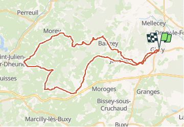
givry - Villeneuve en montagne

XavierFaidix
User

Length
42 km

Max alt
462 m

Uphill gradient
740 m
Km-Effort
52 km

Min alt
218 m

Downhill gradient
740 m
Boucle
Yes
Creation date :
2025-02-24 13:19:19.107
Updated on :
2025-02-24 21:40:01.917
3h00
Difficulty : Medium

FREE GPS app for hiking
 SityTrail
IGN / Geographical institutes
SityTrail Plus
The world is yours!
About
Trail Road bike of 42 km to be discovered at Bourgogne-Franche-Comté, Saône-et-Loire, Givry. This trail is proposed by XavierFaidix.
Positioning
Country:
France
Region :
Bourgogne-Franche-Comté
Department/Province :
Saône-et-Loire
Municipality :
Givry
Location:
Unknown
Start:(Dec)
Start:(UTM)
633243 ; 5182578 (31T) N.
Comments