


croix

tosan
User
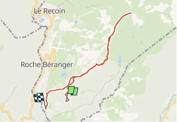

Length
8.1 km

Max alt
2248 m

Uphill gradient
523 m
Km-Effort
15.2 km

Min alt
1691 m

Downhill gradient
553 m
Boucle
No
Creation date :
2025-02-25 14:00:51.856
Updated on :
2025-02-25 16:44:17.158
2h43
Difficulty : Difficult

FREE GPS app for hiking
 SityTrail
IGN / Geographical institutes
SityTrail Plus
The world is yours!
About
Trail Walking of 8.1 km to be discovered at Auvergne-Rhône-Alpes, Isère, Chamrousse. This trail is proposed by tosan.
Positioning
Country:
France
Region :
Auvergne-Rhône-Alpes
Department/Province :
Isère
Municipality :
Chamrousse
Location:
Unknown
Start:(Dec)
Start:(UTM)
726793 ; 4998500 (31T) N.
Comments