


arial2

abies
User
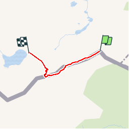

Length
1.6 km

Max alt
2673 m

Uphill gradient
49 m
Km-Effort
2.6 km

Min alt
2540 m

Downhill gradient
144 m
Boucle
No
Creation date :
2016-03-09 00:00:00.0
Updated on :
2016-03-09 00:00:00.0
1h20
Difficulty : Very difficult

FREE GPS app for hiking
 SityTrail
IGN / Geographical institutes
SityTrail Plus
The world is yours!
About
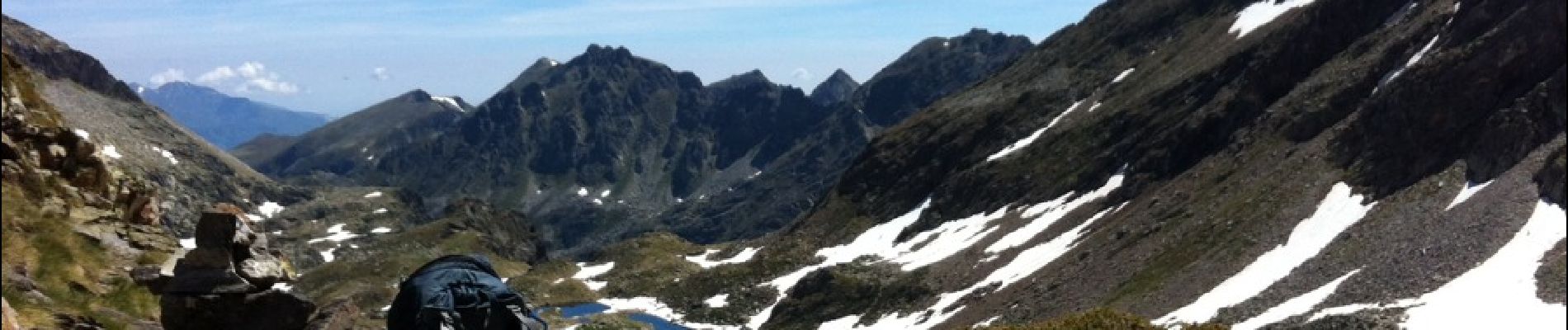
Trail Other activity of 1.6 km to be discovered at Andorra. This trail is proposed by abies.
Description
T
Photos


Positioning
Country:
Andorra
Region :
Unknown
Department/Province :
Unknown
Municipality :
Unknown
Location:
Unknown
Start:(Dec)
Start:(UTM)
381093 ; 4723619 (31T) N.
Comments