


rando JB

oliviergau
User
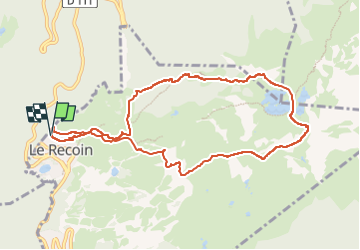

Length
10.4 km

Max alt
2248 m

Uphill gradient
806 m
Km-Effort
21 km

Min alt
1669 m

Downhill gradient
806 m
Boucle
Yes
Creation date :
2025-02-27 08:05:11.374
Updated on :
2025-02-27 14:56:04.866
6h50
Difficulty : Very easy

FREE GPS app for hiking
 SityTrail
IGN / Geographical institutes
SityTrail Plus
The world is yours!
About
Trail Touring skiing of 10.4 km to be discovered at Auvergne-Rhône-Alpes, Isère, Chamrousse. This trail is proposed by oliviergau.
Positioning
Country:
France
Region :
Auvergne-Rhône-Alpes
Department/Province :
Isère
Municipality :
Chamrousse
Location:
Unknown
Start:(Dec)
Start:(UTM)
726133 ; 5001204 (31T) N.
Comments