


bracieux gs15km

cristinette
User
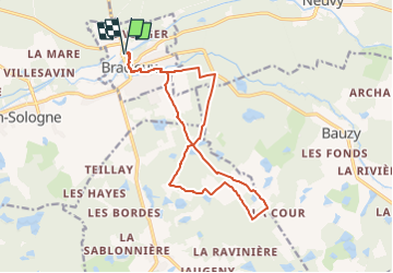

Length
15.3 km

Max alt
114 m

Uphill gradient
103 m
Km-Effort
16.7 km

Min alt
75 m

Downhill gradient
103 m
Boucle
Yes
Creation date :
2025-02-28 15:29:12.985
Updated on :
2025-03-03 15:33:27.818
3h47
Difficulty : Easy

FREE GPS app for hiking
 SityTrail
IGN / Geographical institutes
SityTrail Plus
The world is yours!
About
Trail On foot of 15.3 km to be discovered at Centre-Loire Valley, Loir-et-Cher, Bracieux. This trail is proposed by cristinette.
Positioning
Country:
France
Region :
Centre-Loire Valley
Department/Province :
Loir-et-Cher
Municipality :
Bracieux
Location:
Unknown
Start:(Dec)
Start:(UTM)
390156 ; 5267470 (31T) N.
Comments