


Routo Dignes Dalles Ammonites

taguette
User
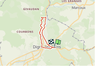

Length
11.4 km

Max alt
711 m

Uphill gradient
237 m
Km-Effort
14.6 km

Min alt
590 m

Downhill gradient
235 m
Boucle
Yes
Creation date :
2025-03-01 08:12:25.952
Updated on :
2025-03-01 15:03:12.558
3h30
Difficulty : Easy

FREE GPS app for hiking
 SityTrail
IGN / Geographical institutes
SityTrail Plus
The world is yours!
About
Trail Walking of 11.4 km to be discovered at Provence-Alpes-Côte d'Azur, Alpes-de-Haute-Provence, Digne-les-Bains. This trail is proposed by taguette.
Positioning
Country:
France
Region :
Provence-Alpes-Côte d'Azur
Department/Province :
Alpes-de-Haute-Provence
Municipality :
Digne-les-Bains
Location:
Unknown
Start:(Dec)
Start:(UTM)
279463 ; 4885643 (32T) N.
Comments