


Saint André de cap ceze

jpaul77
User
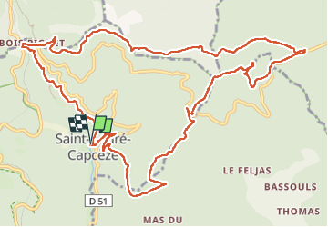

Length
15.8 km

Max alt
984 m

Uphill gradient
613 m
Km-Effort
24 km

Min alt
473 m

Downhill gradient
610 m
Boucle
Yes
Creation date :
2025-03-01 09:08:34.707
Updated on :
2025-03-01 15:04:10.58
5h54
Difficulty : Medium

FREE GPS app for hiking
 SityTrail
IGN / Geographical institutes
SityTrail Plus
The world is yours!
About
Trail Walking of 15.8 km to be discovered at Occitania, Lozère, Saint-André-Capcèze. This trail is proposed by jpaul77.
Positioning
Country:
France
Region :
Occitania
Department/Province :
Lozère
Municipality :
Saint-André-Capcèze
Location:
Unknown
Start:(Dec)
Start:(UTM)
575497 ; 4918664 (31T) N.
Comments