


Marcinelle 01 03 25

andremusin
User
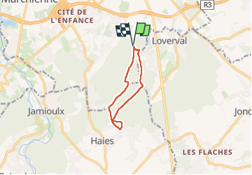

Length
7.5 km

Max alt
232 m

Uphill gradient
108 m
Km-Effort
9 km

Min alt
155 m

Downhill gradient
108 m
Boucle
Yes
Creation date :
2025-03-01 13:29:26.268
Updated on :
2025-03-01 15:14:39.768
1h36
Difficulty : Very easy

FREE GPS app for hiking
 SityTrail
IGN / Geographical institutes
SityTrail Plus
The world is yours!
About
Trail Nordic walking of 7.5 km to be discovered at Wallonia, Hainaut, Charleroi. This trail is proposed by andremusin.
Positioning
Country:
Belgium
Region :
Wallonia
Department/Province :
Hainaut
Municipality :
Charleroi
Location:
Unknown
Start:(Dec)
Start:(UTM)
603515 ; 5581168 (31U) N.
Comments