


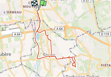
Rond point d'Alstom Barbazan aller retour

Denis couderc
User

Length
9.6 km

Max alt
352 m

Uphill gradient
53 m
Km-Effort
10.3 km

Min alt
319 m

Downhill gradient
53 m
Boucle
Yes
Creation date :
2025-03-01 13:36:19.529
Updated on :
2025-03-01 16:43:50.297
3h06
Difficulty : Medium

FREE GPS app for hiking
 SityTrail
IGN / Geographical institutes
SityTrail Plus
The world is yours!
About
Trail Walking of 9.6 km to be discovered at Occitania, Hautespyrenees, Séméac. This trail is proposed by Denis couderc.
Positioning
Country:
France
Region :
Occitania
Department/Province :
Hautespyrenees
Municipality :
Séméac
Location:
Unknown
Start:(Dec)
Start:(UTM)
263958 ; 4789769 (31T) N.
Comments