


Pointe

nicolasdresse
User
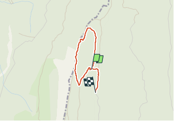

Length
2.4 km

Max alt
1601 m

Uphill gradient
95 m
Km-Effort
3.8 km

Min alt
1472 m

Downhill gradient
122 m
Boucle
No
Creation date :
2025-03-02 09:29:41.0
Updated on :
2025-03-02 14:54:55.444
2h17
Difficulty : Easy
2h17
Difficulty : Easy

FREE GPS app for hiking
 SityTrail
IGN / Geographical institutes
SityTrail Plus
The world is yours!
About
Trail Walking of 2.4 km to be discovered at Auvergne-Rhône-Alpes, Isère, Autrans-Méaudre en Vercors. This trail is proposed by nicolasdresse.
Positioning
Country:
France
Region :
Auvergne-Rhône-Alpes
Department/Province :
Isère
Municipality :
Autrans-Méaudre en Vercors
Location:
Autrans
Start:(Dec)
Start:(UTM)
699387 ; 5010713 (31T) N.
Comments