


Pravouta le 3 3 25

bymarc26
User
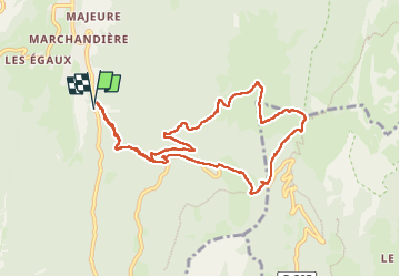

Length
10 km

Max alt
1754 m

Uphill gradient
799 m
Km-Effort
21 km

Min alt
963 m

Downhill gradient
795 m
Boucle
Yes
Creation date :
2025-03-03 08:32:44.395
Updated on :
2025-03-03 14:04:59.658
3h36
Difficulty : Medium

FREE GPS app for hiking
 SityTrail
IGN / Geographical institutes
SityTrail Plus
The world is yours!
About
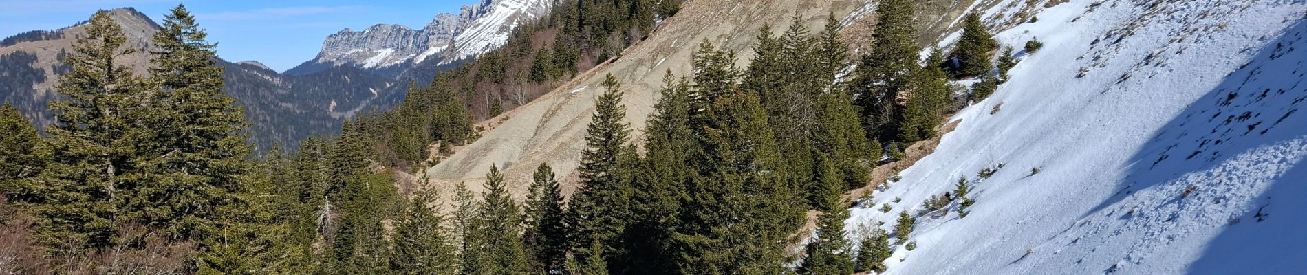
Trail Walking of 10 km to be discovered at Auvergne-Rhône-Alpes, Isère, Saint-Pierre-de-Chartreuse. This trail is proposed by bymarc26.
Description
magnifique rando
au sommet vue à 360 sur tous les massifs.
Photos


Positioning
Country:
France
Region :
Auvergne-Rhône-Alpes
Department/Province :
Isère
Municipality :
Saint-Pierre-de-Chartreuse
Location:
Unknown
Start:(Dec)
Start:(UTM)
720259 ; 5021355 (31T) N.
Comments