


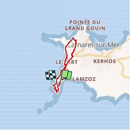
Circuit de la pointe de Pen Hir

Dervalmarc
User

Length
8.8 km

Max alt
59 m

Uphill gradient
163 m
Km-Effort
11 km

Min alt
6 m

Downhill gradient
158 m
Boucle
Yes
Creation date :
2015-06-23 00:00:00.0
Updated on :
2015-06-23 00:00:00.0
2h18
Difficulty : Easy

FREE GPS app for hiking
 SityTrail
IGN / Geographical institutes
SityTrail Plus
The world is yours!
About
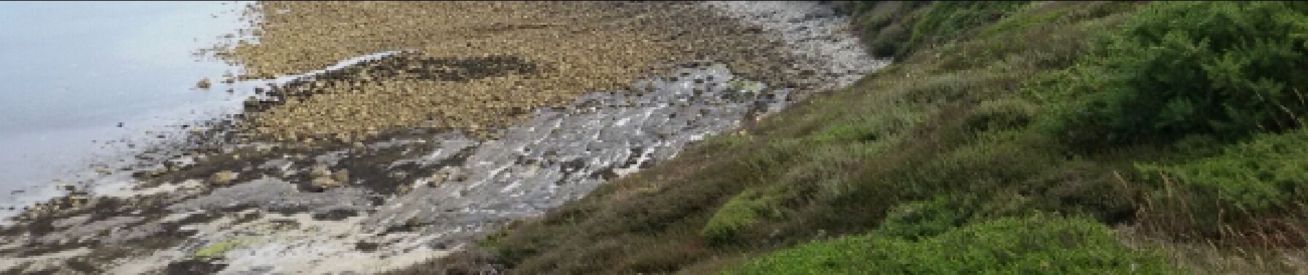
Trail Walking of 8.8 km to be discovered at Brittany, Finistère, Camaret-sur-Mer. This trail is proposed by Dervalmarc.
Photos


Positioning
Country:
France
Region :
Brittany
Department/Province :
Finistère
Municipality :
Camaret-sur-Mer
Location:
Unknown
Start:(Dec)
Start:(UTM)
379765 ; 5346317 (30U) N.
Comments
1
1