


Destel azur

cousam
User
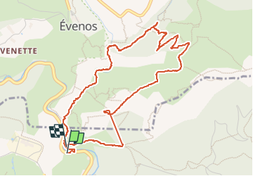

Length
5.9 km

Max alt
376 m

Uphill gradient
337 m
Km-Effort
10.4 km

Min alt
76 m

Downhill gradient
332 m
Boucle
Yes
Creation date :
2025-03-04 08:41:07.425
Updated on :
2025-03-06 16:45:06.808
5h41
Difficulty : Difficult

FREE GPS app for hiking
 SityTrail
IGN / Geographical institutes
SityTrail Plus
The world is yours!
About
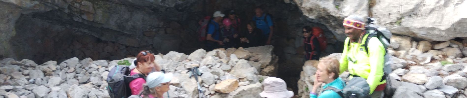
Trail Walking of 5.9 km to be discovered at Provence-Alpes-Côte d'Azur, Var, Ollioules. This trail is proposed by cousam.
Photos


47 photos in total. Please click on a photo to see them all in the gallery.
Positioning
Country:
France
Region :
Provence-Alpes-Côte d'Azur
Department/Province :
Var
Municipality :
Ollioules
Location:
Unknown
Start:(Dec)
Start:(UTM)
731360 ; 4781574 (31T) N.
Comments