


Autrans la Sure

lionelnottat
User
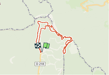

Length
11.5 km

Max alt
1636 m

Uphill gradient
576 m
Km-Effort
19.2 km

Min alt
1296 m

Downhill gradient
576 m
Boucle
Yes
Creation date :
2025-03-04 08:13:51.799
Updated on :
2025-03-04 17:27:06.604
3h22
Difficulty : Medium

FREE GPS app for hiking
 SityTrail
IGN / Geographical institutes
SityTrail Plus
The world is yours!
About
Trail Snowshoes of 11.5 km to be discovered at Auvergne-Rhône-Alpes, Isère, Autrans-Méaudre en Vercors. This trail is proposed by lionelnottat.
Positioning
Country:
France
Region :
Auvergne-Rhône-Alpes
Department/Province :
Isère
Municipality :
Autrans-Méaudre en Vercors
Location:
Autrans
Start:(Dec)
Start:(UTM)
702664 ; 5011666 (31T) N.
Comments