


20250304 Menesqueville

Childebert
User
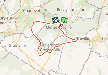

Length
12.8 km

Max alt
131 m

Uphill gradient
180 m
Km-Effort
15.2 km

Min alt
43 m

Downhill gradient
180 m
Boucle
Yes
Creation date :
2025-03-04 13:06:53.665
Updated on :
2025-03-04 18:05:00.863
3h26
Difficulty : Difficult

FREE GPS app for hiking
 SityTrail
IGN / Geographical institutes
SityTrail Plus
The world is yours!
About
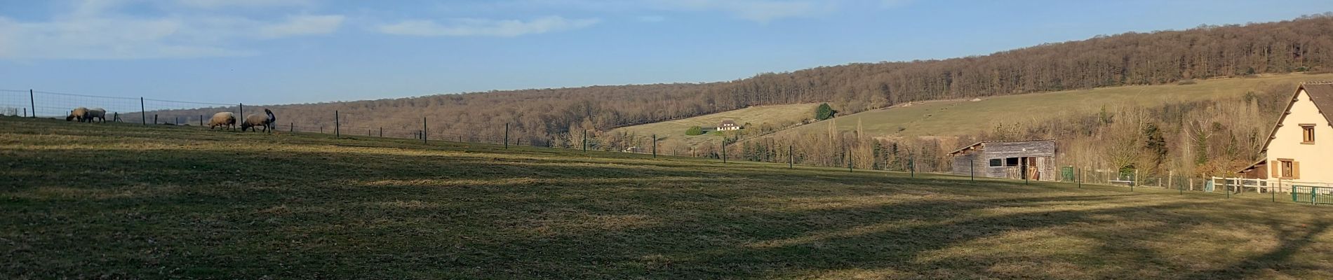
Trail Walking of 12.8 km to be discovered at Normandy, Eure, Ménesqueville. This trail is proposed by Childebert.
Photos

Positioning
Country:
France
Region :
Normandy
Department/Province :
Eure
Municipality :
Ménesqueville
Location:
Unknown
Start:(Dec)
Start:(UTM)
385006 ; 5468658 (31U) N.
Comments