


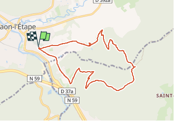
Circuit de Saint Blaise

Emmanuel Remy
User

Length
9.2 km

Max alt
562 m

Uphill gradient
286 m
Km-Effort
13 km

Min alt
305 m

Downhill gradient
287 m
Boucle
Yes
Creation date :
2025-03-05 10:02:09.541
Updated on :
2025-03-05 10:02:09.541
2h57
Difficulty : Easy

FREE GPS app for hiking
 SityTrail
IGN / Geographical institutes
SityTrail Plus
The world is yours!
About
Trail On foot of 9.2 km to be discovered at Grand Est, Vosges, Raon-l'Étape. This trail is proposed by Emmanuel Remy.
Description
circuit de Saint Blaise, départ parking cimetière rive droite, maison forestière du Grand Fays, roche Saint Blaise, abri des Chasseurs, tête du Pouillot, Chavré, belvédère de la carrière de trapp.
Positioning
Country:
France
Region :
Grand Est
Department/Province :
Vosges
Municipality :
Raon-l'Étape
Location:
Unknown
Start:(Dec)
Start:(UTM)
341022 ; 5363217 (32U) N.
Comments