


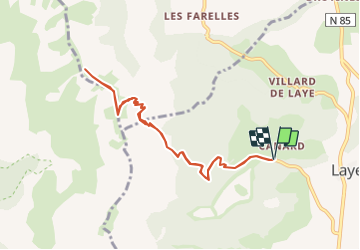
Laye - Coste Belle

frizou83
User

Length
9.2 km

Max alt
1983 m

Uphill gradient
691 m
Km-Effort
18.4 km

Min alt
1300 m

Downhill gradient
690 m
Boucle
Yes
Creation date :
2015-06-24 00:00:00.0
Updated on :
2015-06-24 00:00:00.0
3h50
Difficulty : Difficult

FREE GPS app for hiking
 SityTrail
IGN / Geographical institutes
SityTrail Plus
The world is yours!
About
Trail Walking of 9.2 km to be discovered at Provence-Alpes-Côte d'Azur, Hautes-Alpes, Laye. This trail is proposed by frizou83.
Description
Aller-retour
Positioning
Country:
France
Region :
Provence-Alpes-Côte d'Azur
Department/Province :
Hautes-Alpes
Municipality :
Laye
Location:
Unknown
Start:(Dec)
Start:(UTM)
267900 ; 4947372 (32T) N.
Comments