


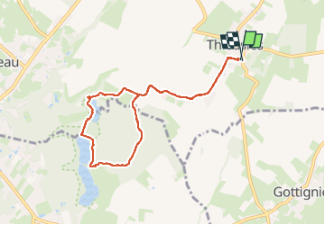
Boucle Thieusies - Saint-Denis par Étangs

CapTom
User

Length
7.4 km

Max alt
110 m

Uphill gradient
77 m
Km-Effort
8.4 km

Min alt
60 m

Downhill gradient
76 m
Boucle
Yes
Creation date :
2025-03-07 12:01:06.0
Updated on :
2025-03-07 13:35:14.462
1h30
Difficulty : Medium

FREE GPS app for hiking
 SityTrail
IGN / Geographical institutes
SityTrail Plus
The world is yours!
About
Trail Walking of 7.4 km to be discovered at Wallonia, Hainaut, Soignies. This trail is proposed by CapTom.
Positioning
Country:
Belgium
Region :
Wallonia
Department/Province :
Hainaut
Municipality :
Soignies
Location:
Unknown
Start:(Dec)
Start:(UTM)
574444 ; 5596220 (31U) N.
Comments