


Tourrettes -Santone

ash
User
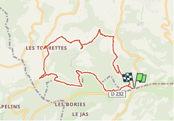

Length
11.7 km

Max alt
542 m

Uphill gradient
323 m
Km-Effort
16 km

Min alt
308 m

Downhill gradient
323 m
Boucle
Yes
Creation date :
2025-03-07 09:41:49.0
Updated on :
2025-03-07 13:52:16.993

FREE GPS app for hiking
 SityTrail
IGN / Geographical institutes
SityTrail Plus
The world is yours!
About
Trail of 11.7 km to be discovered at Provence-Alpes-Côte d'Azur, Vaucluse, Buoux. This trail is proposed by ash.
Positioning
Country:
France
Region :
Provence-Alpes-Côte d'Azur
Department/Province :
Vaucluse
Municipality :
Buoux
Location:
Unknown
Start:(Dec)
Start:(UTM)
692126 ; 4857370 (31T) N.
Comments