


sireix arcizan G3 Turin de benne

LouisROGER
User GUIDE
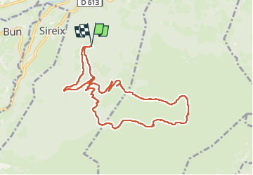

Length
10.4 km

Max alt
1578 m

Uphill gradient
472 m
Km-Effort
16.7 km

Min alt
1157 m

Downhill gradient
471 m
Boucle
Yes
Creation date :
2025-03-07 08:28:10.12
Updated on :
2025-03-07 14:37:15.564
6h08
Difficulty : Difficult

FREE GPS app for hiking
 SityTrail
IGN / Geographical institutes
SityTrail Plus
The world is yours!
About
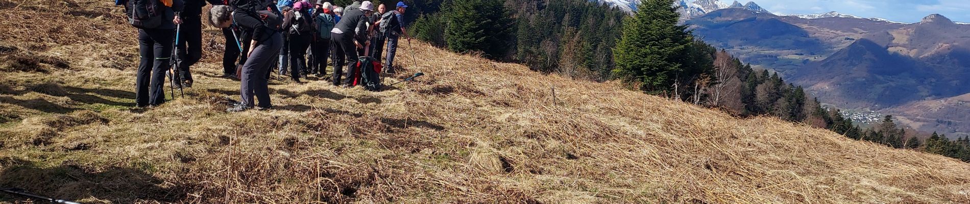
Trail Walking of 10.4 km to be discovered at Occitania, Hautespyrenees, Arras-en-Lavedan. This trail is proposed by LouisROGER.
Photos

Positioning
Country:
France
Region :
Occitania
Department/Province :
Hautespyrenees
Municipality :
Arras-en-Lavedan
Location:
Unknown
Start:(Dec)
Start:(UTM)
733404 ; 4761750 (30T) N.
Comments