Trail Walking Ottrott - Obernai-150625 - SteOdile-MurPaien - Photo

Obernai-150625 - SteOdile-MurPaien

 randodan
randodan

User

© OpenStreetMap contributors
Length
Length
7.5 km
Max alt
Max alt
765 m
Uphill gradient
Uphill gradient
254 m
Km-Effort
Km-Effort  
10.9 km
Min alt
Min alt
591 m
Downhill gradient
Downhill gradient
248 m
Boucle
Boucle
Yes
Creation date :
2015-07-04 00:00:00.0
Updated on :
2015-07-04 00:00:00.0

(0 Reviews)

Walking
Walking
2h45
Difficulty : Easy

Scan this QR Code to open this trail in the SityTrail application

FREE GPS app for hiking

Logo SityTrail SityTrail

IGN / Geographical institutes

Download SityTrail from the App Store Download SityTrail from Google Play

Logo SityTrail SityTrail World

The world is yours!

Download SityTrail from the App Store Download SityTrail from Google Play Download SityTrail on Huawei AppGallery

About

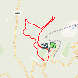
Trail Walking of 7.5 km to be discovered at Grand Est, Bas-Rhin, Ottrott. This trail is proposed by randodan.

Description

Obernais, 25 juin 2015<br>
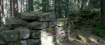
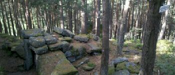
- Mont Sainte-Odile, Mur Païen -<br>
(d'après le randoguide de VacheKiri67 que je remercie au passage)<br>
9h15, départ du parking du haut du Mont Sainte-Odile.<br>
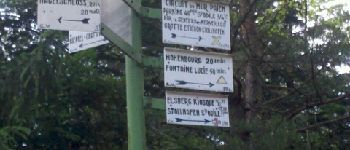
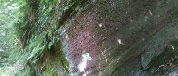
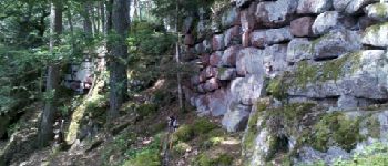
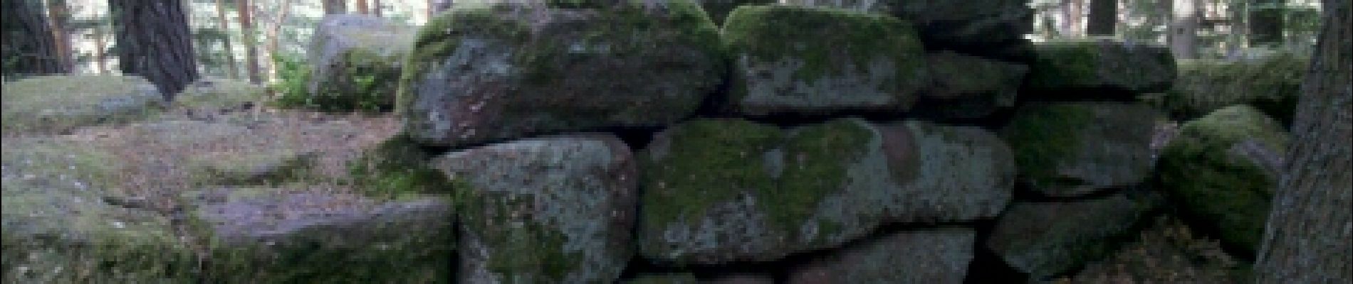
Le Mur Païen, impressionnant de voir les blocs que les Celtes (??) manipulaient ! Les photos parlent d'elles-même . Porte Koeberlé, une belle entrée aménagée dans le "Mur" . Zut, loupé le Château Hagelschloss, je n'ai pas vu sur le panneau du bout du circuit Nord qu'il n'était qu'à 20 m seulement du carrefour . Porte Nord, je quitte le "Mur" pour faire la crête jusqu'au Hohenburgerberg.<br>
Retour par le Sentier des Merveilles . Tous les 50 ou 100 m (sur les 1200 m du sentier), une sculpture d'animal en bois, oeuvre du bûcheron Alfred Baumgart.<br>
11h45, de retour à  la voiture.<br>
Rando en solo.<br>
<small>Nota : Il y avait beaucoup de choses à voir et j'en ai ratées, j'aurais dû mieux préparer ce circuit.</small>

Elevation profile

Photos

Points of interest

Point of interest Ottrott - 01 - Le Mur Païen - Photo
randodan
Point of interest Ottrott - 02 - Le Mur Païen - Photo
randodan
Point of interest Ottrott - 03 - Le Mur Païen - Photo
randodan

Positioning

Country:
France
Region :
Grand Est
Department/Province :
Bas-Rhin
Municipality :
Ottrott
Location:
Unknown
Start:(UTM)
381851 ; 5366019 (32U) N.

Trails nearby

Trail Walking Ottrott - Le circuit sud du Mur Païen - Photo
Walking
VacheKiri67

Walking

Easy
(2)
Ottrott, Grand Est, Bas-Rhin, France
4.9 km | 6.3 km-effort
1h 56min
No
Trail Walking Ottrott - Le circuit nord du Mur Païen - Photo
Walking
VacheKiri67

Walking

Easy
(1)
Ottrott, Grand Est, Bas-Rhin, France
5.9 km | 8.5 km-effort
2h 4min
No
Trail Walking Ottrott - Le Mont Sainte-Odile depuis Otrott - Photo
Walking
VacheKiri67

Walking

Medium
(1)
Ottrott, Grand Est, Bas-Rhin, France
13 km | 20 km-effort
6h 18min
Yes
Trail Walking Ottrott - Montée vers le Mont Sainte-Odile - Photo
Walking
VacheKiri67

Walking

Difficult
(1)
Ottrott, Grand Est, Bas-Rhin, France
17.6 km | 26 km-effort
5h 52min
Yes
Trail Walking Ottrott - Le mur païen - Photo
Walking
VacheKiri67

Walking

Medium
(4)
Ottrott, Grand Est, Bas-Rhin, France
10.5 km | 14.5 km-effort
4h 36min
Yes
Trail Walking Ottrott - Mur Paien complet - Photo
Walking
markrei

Walking

Medium
(1)
Ottrott, Grand Est, Bas-Rhin, France
12 km | 16.4 km-effort
5h 25min
Yes
Trail Mountain bike Barr - Circuit des 3 Petits Ponts - Photo
Mountain bike
tracegps

Mountain bike

Difficult
(1)
Barr, Grand Est, Bas-Rhin, France
15.9 km | 22 km-effort
1h 19min
Yes
Trail Mountain bike Ottrott - Sainte-Odile East-Face - Photo
Mountain bike
tracegps

Mountain bike

Difficult
(1)
Ottrott, Grand Est, Bas-Rhin, France
24 km | 39 km-effort
3h 0min
Yes
Trail Walking Obernai - sentier des merveilles - Photo
Walking
semila

Walking

Difficult
(1)
Obernai, Grand Est, Bas-Rhin, France
11 km | 16.6 km-effort
4h 8min
Yes


Close
My subscriptions