


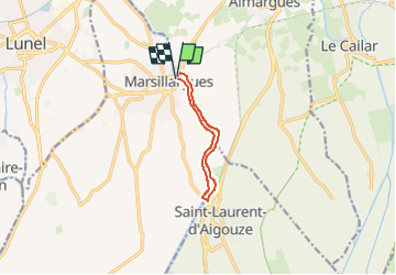
le long du Vidourle, de Marsillargues à St Laurent d'Aigouze

34christophe
User

Length
7.8 km

Max alt
15 m

Uphill gradient
46 m
Km-Effort
8.4 km

Min alt
1 m

Downhill gradient
49 m
Boucle
Yes
Creation date :
2025-03-09 10:14:32.472
Updated on :
2025-03-09 10:17:49.363
1h54
Difficulty : Easy

FREE GPS app for hiking
 SityTrail
IGN / Geographical institutes
SityTrail Plus
The world is yours!
About
Trail On foot of 7.8 km to be discovered at Occitania, Hérault, Marsillargues. This trail is proposed by 34christophe.
Description
en boucle de chaque côté du fleuve
Positioning
Country:
France
Region :
Occitania
Department/Province :
Hérault
Municipality :
Marsillargues
Location:
Unknown
Start:(Dec)
Start:(UTM)
595308 ; 4835508 (31T) N.
Comments