


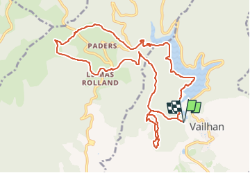
lac des Olivettes, Vailhan, Mas de Rolland

34christophe
User

Length
12.3 km

Max alt
363 m

Uphill gradient
349 m
Km-Effort
17 km

Min alt
133 m

Downhill gradient
349 m
Boucle
Yes
Creation date :
2025-03-09 11:17:32.79
Updated on :
2025-03-09 11:18:28.066
3h51
Difficulty : Easy

FREE GPS app for hiking
 SityTrail
IGN / Geographical institutes
SityTrail Plus
The world is yours!
About
Trail On foot of 12.3 km to be discovered at Occitania, Hérault, Vailhan. This trail is proposed by 34christophe.
Positioning
Country:
France
Region :
Occitania
Department/Province :
Hérault
Municipality :
Vailhan
Location:
Unknown
Start:(Dec)
Start:(UTM)
523983 ; 4822383 (31T) N.
Comments