


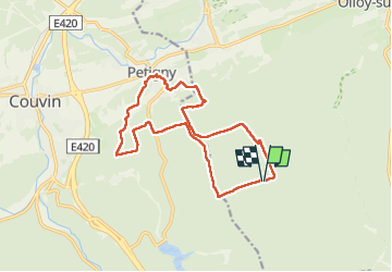
Viroinval Trail

daniel_2w
User

Length
14.1 km

Max alt
342 m

Uphill gradient
436 m
Km-Effort
19.9 km

Min alt
169 m

Downhill gradient
437 m
Boucle
Yes
Creation date :
2025-03-10 12:08:24.737
Updated on :
2025-03-10 12:09:02.337
0m
Difficulty : Medium

FREE GPS app for hiking
 SityTrail
IGN / Geographical institutes
SityTrail Plus
The world is yours!
About
Trail Nordic walking of 14.1 km to be discovered at Wallonia, Namur, Viroinval. This trail is proposed by daniel_2w.
Positioning
Country:
Belgium
Region :
Wallonia
Department/Province :
Namur
Municipality :
Viroinval
Location:
Unknown
Start:(Dec)
Start:(UTM)
612280 ; 5543828 (31U) N.
Comments