


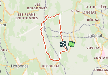
AIN: COL DE RICHEMONT NORD

djeepee74
User

Length
12.3 km

Max alt
1227 m

Uphill gradient
287 m
Km-Effort
16.1 km

Min alt
1021 m

Downhill gradient
284 m
Boucle
Yes
Creation date :
2025-03-09 12:15:22.056
Updated on :
2025-03-31 18:25:05.531
3h39
Difficulty : Medium

FREE GPS app for hiking
 SityTrail
IGN / Geographical institutes
SityTrail Plus
The world is yours!
About
Trail Walking of 12.3 km to be discovered at Auvergne-Rhône-Alpes, Ain, Chanay. This trail is proposed by djeepee74.
Description
BOUCLE ... live du 20250309
... au départ, de la route sur 1,2 Km !
Positioning
Country:
France
Region :
Auvergne-Rhône-Alpes
Department/Province :
Ain
Municipality :
Chanay
Location:
Unknown
Start:(Dec)
Start:(UTM)
712685 ; 5098772 (31T) N.
Comments