


Les chalets d'Izoard (Cervières 05)

Clo0413
User
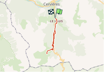

Length
9.4 km

Max alt
2238 m

Uphill gradient
498 m
Km-Effort
16 km

Min alt
1736 m

Downhill gradient
498 m
Boucle
Yes
Creation date :
2025-03-11 08:37:46.279
Updated on :
2025-03-14 13:59:14.532
3h14
Difficulty : Medium

FREE GPS app for hiking
 SityTrail
IGN / Geographical institutes
SityTrail Plus
The world is yours!
About
Trail Walking of 9.4 km to be discovered at Provence-Alpes-Côte d'Azur, Hautes-Alpes, Cervières. This trail is proposed by Clo0413.
Description
Randonnée raquettes
Positioning
Country:
France
Region :
Provence-Alpes-Côte d'Azur
Department/Province :
Hautes-Alpes
Municipality :
Cervières
Location:
Unknown
Start:(Dec)
Start:(UTM)
320296 ; 4969675 (32T) N.
Comments