


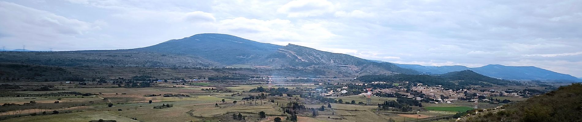
Montbrun des Corbières

Licianus2
User GUIDE
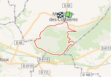

Length
6.6 km

Max alt
197 m

Uphill gradient
126 m
Km-Effort
8.3 km

Min alt
107 m

Downhill gradient
128 m
Boucle
Yes
Creation date :
2025-03-11 13:23:38.046
Updated on :
2025-03-11 18:45:17.668
1h53
Difficulty : Medium

FREE GPS app for hiking
 SityTrail
IGN / Geographical institutes
SityTrail Plus
The world is yours!
About
Trail Walking of 6.6 km to be discovered at Occitania, Aude, Montbrun-des-Corbières. This trail is proposed by Licianus2.
Description
le rocher du renard, variante au balisage officiel.
Photos


Positioning
Country:
France
Region :
Occitania
Department/Province :
Aude
Municipality :
Montbrun-des-Corbières
Location:
Unknown
Start:(Dec)
Start:(UTM)
474342 ; 4782759 (31T) N.
Comments