


fin toto

pablo92
User
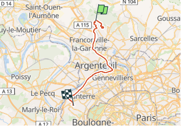

Length
32 km

Max alt
187 m

Uphill gradient
339 m
Km-Effort
37 km

Min alt
17 m

Downhill gradient
455 m
Boucle
No
Creation date :
2025-03-11 16:35:31.823
Updated on :
2025-03-11 19:32:20.49
2h56
Difficulty : Very difficult

FREE GPS app for hiking
 SityTrail
IGN / Geographical institutes
SityTrail Plus
The world is yours!
About
Trail Walking of 32 km to be discovered at Ile-de-France, Val-d'Oise, Saint-Leu-la-Forêt. This trail is proposed by pablo92.
Positioning
Country:
France
Region :
Ile-de-France
Department/Province :
Val-d'Oise
Municipality :
Saint-Leu-la-Forêt
Location:
Unknown
Start:(Dec)
Start:(UTM)
445060 ; 5430831 (31U) N.
Comments