


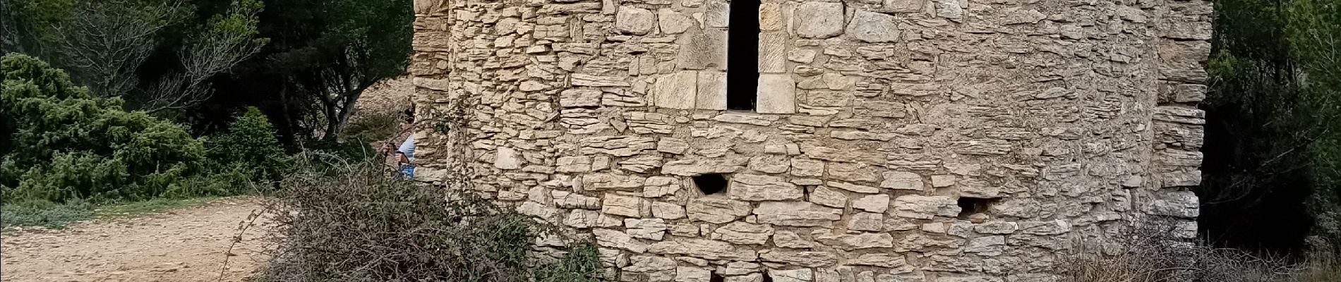
Mornas forteresse et chapelle

FLORENSAC
User
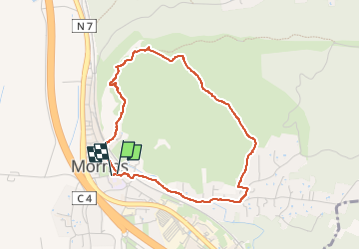

Length
4 km

Max alt
186 m

Uphill gradient
143 m
Km-Effort
5.9 km

Min alt
36 m

Downhill gradient
145 m
Boucle
Yes
Creation date :
2025-03-12 13:33:52.892
Updated on :
2025-03-12 15:19:02.731
1h44
Difficulty : Easy

FREE GPS app for hiking
 SityTrail
IGN / Geographical institutes
SityTrail Plus
The world is yours!
About
Trail Walking of 4 km to be discovered at Provence-Alpes-Côte d'Azur, Vaucluse, Mornas. This trail is proposed by FLORENSAC.
Description
Boucle par la forteresse de Mornas et la chapelle st Baudile
Photos


Positioning
Country:
France
Region :
Provence-Alpes-Côte d'Azur
Department/Province :
Vaucluse
Municipality :
Mornas
Location:
Unknown
Start:(Dec)
Start:(UTM)
638230 ; 4895616 (31T) N.
Comments