


St léger.

Magali BAHUON
User

Length
8.6 km

Max alt
30 m

Uphill gradient
94 m
Km-Effort
9.8 km

Min alt
0 m

Downhill gradient
97 m
Boucle
Yes
Creation date :
2025-02-22 13:12:51.228
Updated on :
2025-03-13 16:18:50.447
2h57
Difficulty : Medium

FREE GPS app for hiking
 SityTrail
IGN / Geographical institutes
SityTrail Plus
The world is yours!
About
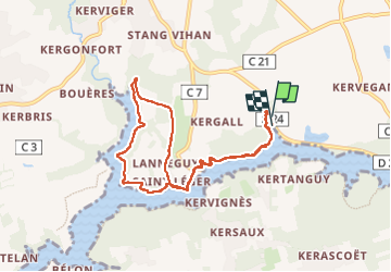
Trail Walking of 8.6 km to be discovered at Brittany, Finistère, Riec-sur-Bélon. This trail is proposed by Magali BAHUON.
Positioning
Country:
France
Region :
Brittany
Department/Province :
Finistère
Municipality :
Riec-sur-Bélon
Location:
Unknown
Start:(Dec)
Start:(UTM)
449641 ; 5297439 (30T) N.
Comments