


Muang Gnoy

aldaus
User
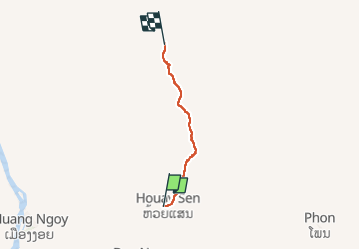

Length
7.5 km

Max alt
1042 m

Uphill gradient
717 m
Km-Effort
14.8 km

Min alt
384 m

Downhill gradient
65 m
Boucle
No
Creation date :
2025-03-14 01:10:09.767
Updated on :
2025-03-15 05:48:14.152
2h45
Difficulty : Difficult

FREE GPS app for hiking
 SityTrail
IGN / Geographical institutes
SityTrail Plus
The world is yours!
About
Trail Walking of 7.5 km to be discovered at Luang Prabang, Ngoy District. This trail is proposed by aldaus.
Positioning
Country:
Lao People's Democratic Republic
Region :
Luang Prabang
Department/Province :
Ngoy District
Municipality :
Unknown
Location:
Unknown
Start:(Dec)
Start:(UTM)
262737 ; 2292190 (48Q) N.
Comments