


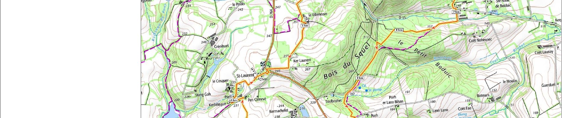
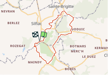
Silfiac_01_ChapelleStLaurent_BoisDuSquel

patrickdanilo
User

Length
15 km

Max alt
277 m

Uphill gradient
291 m
Km-Effort
18.8 km

Min alt
141 m

Downhill gradient
292 m
Boucle
Yes
Creation date :
2019-02-12 16:20:41.216
Updated on :
2023-09-01 17:56:16.212
4h00
Difficulty : Easy

FREE GPS app for hiking
 SityTrail
IGN / Geographical institutes
SityTrail Plus
The world is yours!
About
Trail Walking of 15 km to be discovered at Brittany, Morbihan, Silfiac. This trail is proposed by patrickdanilo.
Description
Départ: Chapelle St-Laurent
Nom:Circuit Des Crêtes Du Squel
Photos

Positioning
Country:
France
Region :
Brittany
Department/Province :
Morbihan
Municipality :
Silfiac
Location:
Unknown
Start:(Dec)
Start:(UTM)
488539 ; 5331343 (30U) N.
Comments