


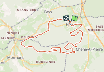
Harre 20km école

maleclere
User

Length
20 km

Max alt
481 m

Uphill gradient
596 m
Km-Effort
28 km

Min alt
213 m

Downhill gradient
606 m
Boucle
Yes
Creation date :
2025-03-16 14:51:25.972
Updated on :
2025-03-16 14:51:31.768
5h45
Difficulty : Medium

FREE GPS app for hiking
 SityTrail
IGN / Geographical institutes
SityTrail Plus
The world is yours!
About
Trail Walking of 20 km to be discovered at Wallonia, Luxembourg, Manhay. This trail is proposed by maleclere.
Positioning
Country:
Belgium
Region :
Wallonia
Department/Province :
Luxembourg
Municipality :
Manhay
Location:
Unknown
Start:(Dec)
Start:(UTM)
689097 ; 5581059 (31U) N.
Comments