


Havré - saint Antoine 1

CapTom
User

Length
3.4 km

Max alt
80 m

Uphill gradient
45 m
Km-Effort
4 km

Min alt
41 m

Downhill gradient
52 m
Boucle
Yes
Creation date :
2025-03-19 11:27:42.0
Updated on :
2025-03-19 12:05:12.428
36m
Difficulty : Easy

FREE GPS app for hiking
 SityTrail
IGN / Geographical institutes
SityTrail Plus
The world is yours!
About
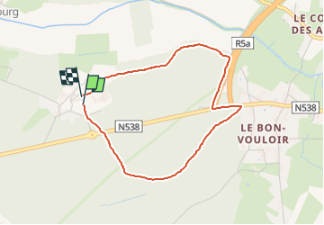
Trail Walking of 3.4 km to be discovered at Wallonia, Hainaut, Mons. This trail is proposed by CapTom.
Positioning
Country:
Belgium
Region :
Wallonia
Department/Province :
Hainaut
Municipality :
Mons
Location:
Havré
Start:(Dec)
Start:(UTM)
572053 ; 5590648 (31U) N.
Comments