


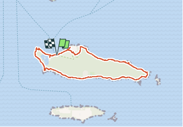
Tour de l'île Ste.Marguerite

rigol05
User

Length
8.5 km

Max alt
42 m

Uphill gradient
99 m
Km-Effort
9.8 km

Min alt
-1 m

Downhill gradient
100 m
Boucle
Yes
Creation date :
2025-03-19 10:26:01.345
Updated on :
2025-03-28 17:14:04.275
2h21
Difficulty : Medium

FREE GPS app for hiking
 SityTrail
IGN / Geographical institutes
SityTrail Plus
The world is yours!
About
Trail Walking of 8.5 km to be discovered at Provence-Alpes-Côte d'Azur, Maritime Alps, Cannes. This trail is proposed by rigol05.
Description
Sortie du 19-03-2025
Positioning
Country:
France
Region :
Provence-Alpes-Côte d'Azur
Department/Province :
Maritime Alps
Municipality :
Cannes
Location:
Unknown
Start:(Dec)
Start:(UTM)
341530 ; 4820635 (32T) N.
Comments