


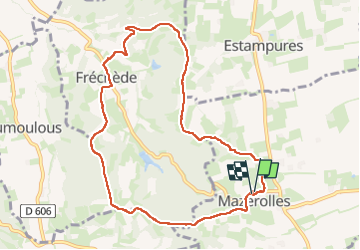
Crêtes de Mazerolles

Prala
User

Length
10 km

Max alt
376 m

Uphill gradient
259 m
Km-Effort
13.5 km

Min alt
226 m

Downhill gradient
259 m
Boucle
Yes
Creation date :
2025-03-19 12:54:28.505
Updated on :
2025-03-19 15:17:41.746
2h22
Difficulty : Easy

FREE GPS app for hiking
 SityTrail
IGN / Geographical institutes
SityTrail Plus
The world is yours!
About
Trail Walking of 10 km to be discovered at Occitania, Hautespyrenees, Mazerolles. This trail is proposed by Prala.
Positioning
Country:
France
Region :
Occitania
Department/Province :
Hautespyrenees
Municipality :
Mazerolles
Location:
Unknown
Start:(Dec)
Start:(UTM)
279709 ; 4803568 (31T) N.
Comments