


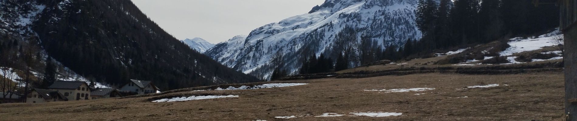
Vallorcine Le Buet

Childebert
User
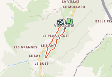

Length
4.4 km

Max alt
1330 m

Uphill gradient
99 m
Km-Effort
5.7 km

Min alt
1254 m

Downhill gradient
99 m
Boucle
Yes
Creation date :
2025-03-20 13:02:32.291
Updated on :
2025-03-20 14:47:52.43
1h44
Difficulty : Easy

FREE GPS app for hiking
 SityTrail
IGN / Geographical institutes
SityTrail Plus
The world is yours!
About
Trail Walking of 4.4 km to be discovered at Auvergne-Rhône-Alpes, Upper Savoy, Vallorcine. This trail is proposed by Childebert.
Photos

Positioning
Country:
France
Region :
Auvergne-Rhône-Alpes
Department/Province :
Upper Savoy
Municipality :
Vallorcine
Location:
Unknown
Start:(Dec)
Start:(UTM)
340059 ; 5099750 (32T) N.
Comments