


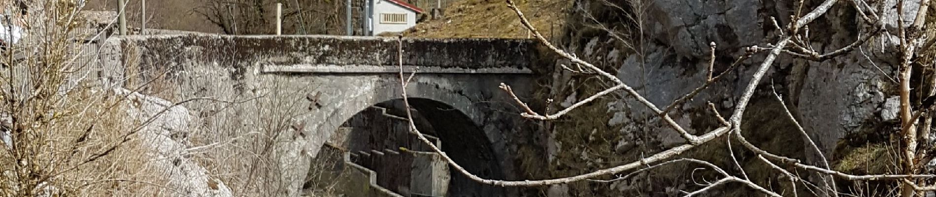
Montanges-Communal-passerelle

HB01
User
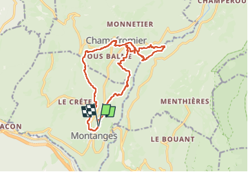

Length
16.7 km

Max alt
797 m

Uphill gradient
601 m
Km-Effort
25 km

Min alt
503 m

Downhill gradient
605 m
Boucle
Yes
Creation date :
2025-03-20 08:51:26.026
Updated on :
2025-03-20 15:40:12.843
4h53
Difficulty : Difficult

FREE GPS app for hiking
 SityTrail
IGN / Geographical institutes
SityTrail Plus
The world is yours!
About
Trail Walking of 16.7 km to be discovered at Auvergne-Rhône-Alpes, Ain, Montanges. This trail is proposed by HB01.
Photos

Positioning
Country:
France
Region :
Auvergne-Rhône-Alpes
Department/Province :
Ain
Municipality :
Montanges
Location:
Unknown
Start:(Dec)
Start:(UTM)
716466 ; 5116388 (31T) N.
Comments