


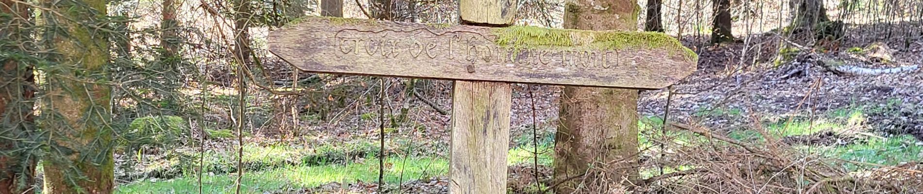
Tignécourt - cascade et grotte bois de l'homme mort - observatoire

Bart2015
User

Length
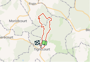
10.8 km

Max alt
354 m

Uphill gradient
185 m
Km-Effort
13.3 km

Min alt
260 m

Downhill gradient
191 m
Boucle
Yes
Creation date :
2025-03-20 12:57:22.077
Updated on :
2025-03-21 16:18:01.629
3h01
Difficulty : Difficult

FREE GPS app for hiking
 SityTrail
IGN / Geographical institutes
SityTrail Plus
The world is yours!
About
Trail Walking of 10.8 km to be discovered at Grand Est, Vosges, Tignécourt. This trail is proposed by Bart2015.
Photos


Positioning
Country:
France
Region :
Grand Est
Department/Province :
Vosges
Municipality :
Tignécourt
Location:
Unknown
Start:(Dec)
Start:(UTM)
715572 ; 5325303 (31U) N.
Comments