


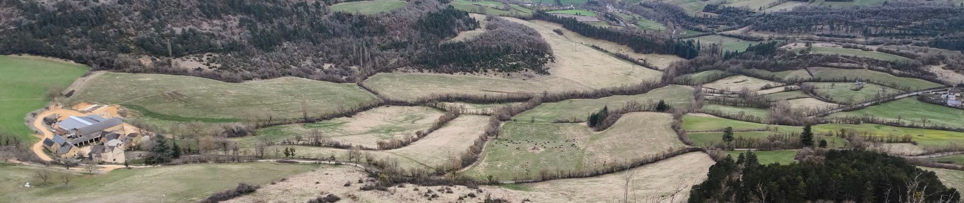
La Cham de Palheret

tyntyn
User
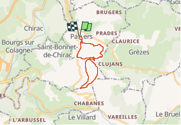

Length
11 km

Max alt
972 m

Uphill gradient
347 m
Km-Effort
15.6 km

Min alt
724 m

Downhill gradient
345 m
Boucle
Yes
Creation date :
2025-03-18 12:32:23.746
Updated on :
2025-03-20 15:56:03.492
3h30
Difficulty : Easy

FREE GPS app for hiking
 SityTrail
IGN / Geographical institutes
SityTrail Plus
The world is yours!
About
Trail Walking of 11 km to be discovered at Occitania, Lozère, Palhers. This trail is proposed by tyntyn.
Photos

Positioning
Country:
France
Region :
Occitania
Department/Province :
Lozère
Municipality :
Palhers
Location:
Unknown
Start:(Dec)
Start:(UTM)
523672 ; 4929624 (31T) N.
Comments