


20250322 Anet

Jeanclaudebic
User
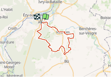

Length
25 km

Max alt
143 m

Uphill gradient
309 m
Km-Effort
29 km

Min alt
65 m

Downhill gradient
311 m
Boucle
Yes
Creation date :
2025-03-22 07:41:14.17
Updated on :
2025-03-22 15:09:11.548
7h27
Difficulty : Very difficult

FREE GPS app for hiking
 SityTrail
IGN / Geographical institutes
SityTrail Plus
The world is yours!
About
Trail Walking of 25 km to be discovered at Centre-Loire Valley, Eure-et-Loir, Anet. This trail is proposed by Jeanclaudebic.
Description
net
Positioning
Country:
France
Region :
Centre-Loire Valley
Department/Province :
Eure-et-Loir
Municipality :
Anet
Location:
Unknown
Start:(Dec)
Start:(UTM)
385463 ; 5412284 (31U) N.
Comments