


Oujda - Al Hoceima

jpipacific
User
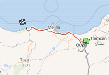

Length
258 km

Max alt
557 m

Uphill gradient
3527 m
Km-Effort
307 km

Min alt
-3 m

Downhill gradient
4022 m
Boucle
No
Creation date :
2025-03-22 10:12:53.16
Updated on :
2025-03-30 12:47:39.79
4h32
Difficulty : Very easy

FREE GPS app for hiking
 SityTrail
IGN / Geographical institutes
SityTrail Plus
The world is yours!
About
Trail Moto cross of 258 km to be discovered at Oriental, Pachalik d'Oujda باشوية وجدة, Oujda. This trail is proposed by jpipacific.
Description
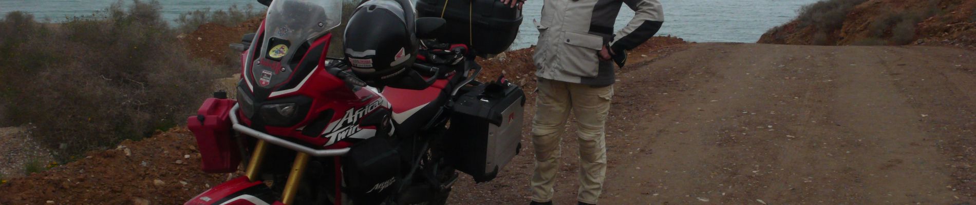
Honda Africa Twin CRF 1000 DCT en duo.
Route en bordure de la frontière Algérienne, puis cote Méditerranéenne jusqu'à Al Hoceima. Temps correct mais frais.
Photos


Positioning
Country:
Morocco
Region :
Oriental
Department/Province :
Pachalik d'Oujda باشوية وجدة
Municipality :
Oujda
Location:
Unknown
Start:(Dec)
Start:(UTM)
599513 ; 3838133 (30S) N.
Comments