


La boucle de Namps

ORTAX
User

Length
49 km

Max alt
137 m

Uphill gradient
602 m
Km-Effort
57 km

Min alt
25 m

Downhill gradient
602 m
Boucle
Yes
Creation date :
2025-03-27 05:12:56.0
Updated on :
2025-03-27 05:12:57.4
3h55
Difficulty : Medium

FREE GPS app for hiking
 SityTrail
IGN / Geographical institutes
SityTrail Plus
The world is yours!
About
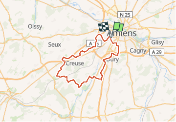
Trail Mountain bike of 49 km to be discovered at Hauts-de-France, Somme, Amiens. This trail is proposed by ORTAX.
Positioning
Country:
France
Region :
Hauts-de-France
Department/Province :
Somme
Municipality :
Amiens
Location:
Unknown
Start:(Dec)
Start:(UTM)
447335 ; 5526087 (31U) N.
Comments