


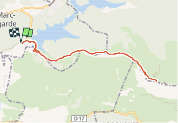
Sainte Victoire par le sentier Imoucha

gerard.colonna
User

Length
10.4 km

Max alt
878 m

Uphill gradient
638 m
Km-Effort
18.9 km

Min alt
325 m

Downhill gradient
640 m
Boucle
Yes
Creation date :
2025-03-27 09:42:19.0
Updated on :
2025-03-27 16:23:15.528

FREE GPS app for hiking
 SityTrail
IGN / Geographical institutes
SityTrail Plus
The world is yours!
About
Trail of 10.4 km to be discovered at Provence-Alpes-Côte d'Azur, Bouches-du-Rhône, Saint-Marc-Jaumegarde. This trail is proposed by gerard.colonna.
Positioning
Country:
France
Region :
Provence-Alpes-Côte d'Azur
Department/Province :
Bouches-du-Rhône
Municipality :
Saint-Marc-Jaumegarde
Location:
Unknown
Start:(Dec)
Start:(UTM)
704502 ; 4824006 (31T) N.
Comments