


NSB2-SourceHuveaune-301024

affinetataille
User GUIDE
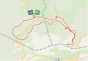

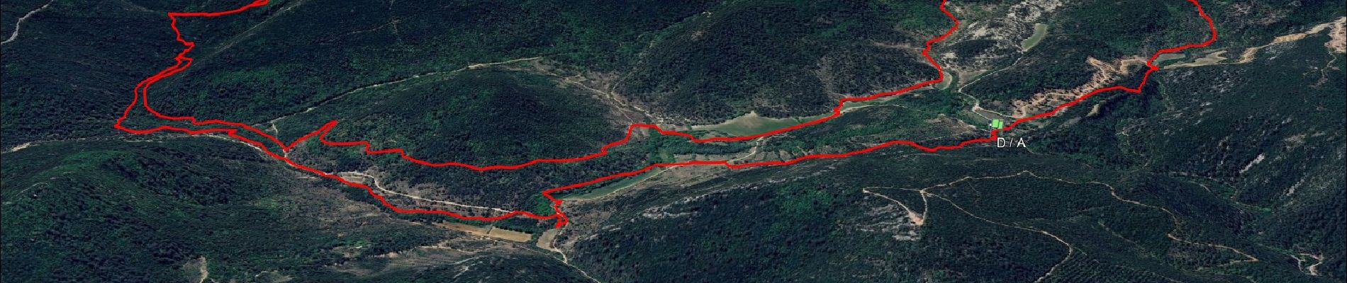
Length
13 km

Max alt
647 m

Uphill gradient
403 m
Km-Effort
18.3 km

Min alt
407 m

Downhill gradient
399 m
Boucle
Yes
Creation date :
2025-03-30 11:55:05.723
Updated on :
2025-04-04 23:55:42.757
6h00
Difficulty : Medium

FREE GPS app for hiking
 SityTrail
IGN / Geographical institutes
SityTrail Plus
The world is yours!
About
Trail Walking of 13 km to be discovered at Provence-Alpes-Côte d'Azur, Var, Saint-Zacharie. This trail is proposed by affinetataille.
Description
grp_trc:
Photos


25 photos in total. Please click on a photo to see them all in the gallery.
Positioning
Country:
France
Region :
Provence-Alpes-Côte d'Azur
Department/Province :
Var
Municipality :
Saint-Zacharie
Location:
Unknown
Start:(Dec)
Start:(UTM)
721679 ; 4804153 (31T) N.
Comments