


Le Teilhet

chasle
User
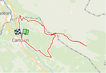

Length
11.6 km

Max alt
1331 m

Uphill gradient
764 m
Km-Effort
22 km

Min alt
651 m

Downhill gradient
762 m
Boucle
Yes
Creation date :
2025-03-30 07:10:22.457
Updated on :
2025-03-30 16:02:42.988
4h09
Difficulty : Difficult

FREE GPS app for hiking
 SityTrail
IGN / Geographical institutes
SityTrail Plus
The world is yours!
About
Trail Walking of 11.6 km to be discovered at Occitania, Hautespyrenees, Campan. This trail is proposed by chasle.
Positioning
Country:
France
Region :
Occitania
Department/Province :
Hautespyrenees
Municipality :
Campan
Location:
Unknown
Start:(Dec)
Start:(UTM)
270057 ; 4766688 (31T) N.
Comments