


GR_34_EG_35_Plestin-Greves_Locquirec_20250430

patrickdanilo
User
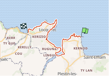

Length
13.2 km

Max alt
52 m

Uphill gradient
217 m
Km-Effort
16.2 km

Min alt
0 m

Downhill gradient
229 m
Boucle
No
Creation date :
2025-03-30 08:12:44.391
Updated on :
2025-04-02 12:31:21.54
4h14
Difficulty : Easy

FREE GPS app for hiking
 SityTrail
IGN / Geographical institutes
SityTrail Plus
The world is yours!
About
Trail Walking of 13.2 km to be discovered at Brittany, Côtes-d'Armor, Plestin-les-Grèves. This trail is proposed by patrickdanilo.
Description
Randonnée Marche de 13,2 km à découvrir à Bretagne, Côtes-d'Armor, Plestin-les-Grèves. Cette randonnée est proposée par patrickdanilo.
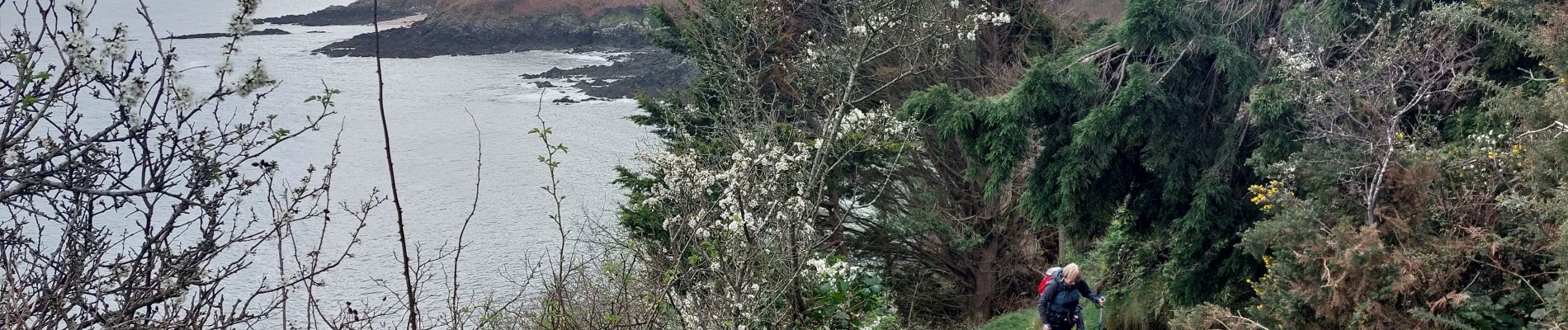
Photos


Positioning
Country:
France
Region :
Brittany
Department/Province :
Côtes-d'Armor
Municipality :
Plestin-les-Grèves
Location:
Unknown
Start:(Dec)
Start:(UTM)
454636 ; 5392455 (30U) N.
Comments