


Le port d' Allon +370

claude nier
User
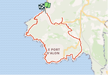

Length
11.7 km

Max alt
146 m

Uphill gradient
370 m
Km-Effort
16.6 km

Min alt
1 m

Downhill gradient
355 m
Boucle
Yes
Creation date :
2025-04-01 09:17:13.874
Updated on :
2025-04-01 16:20:36.887
6h18
Difficulty : Difficult

FREE GPS app for hiking
 SityTrail
IGN / Geographical institutes
SityTrail Plus
The world is yours!
About
Trail Walking of 11.7 km to be discovered at Provence-Alpes-Côte d'Azur, Var, Saint-Cyr-sur-Mer. This trail is proposed by claude nier.
Description
belle rando
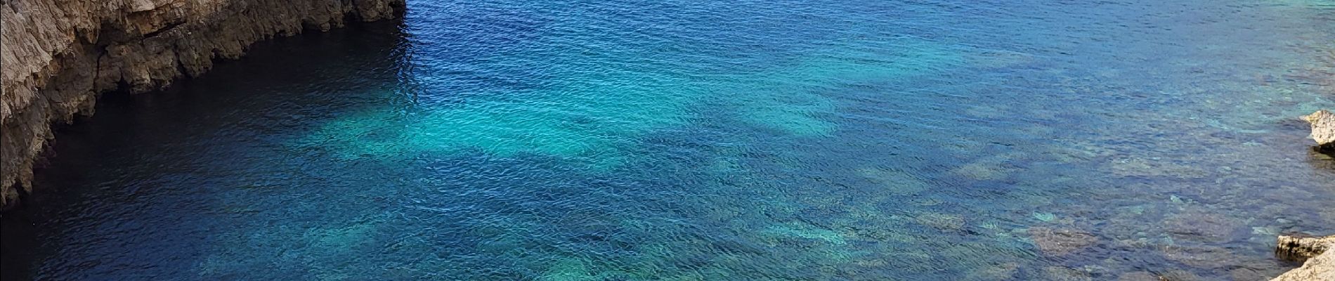
Photos


Positioning
Country:
France
Region :
Provence-Alpes-Côte d'Azur
Department/Province :
Var
Municipality :
Saint-Cyr-sur-Mer
Location:
Unknown
Start:(Dec)
Start:(UTM)
718968 ; 4782701 (31T) N.
Comments