


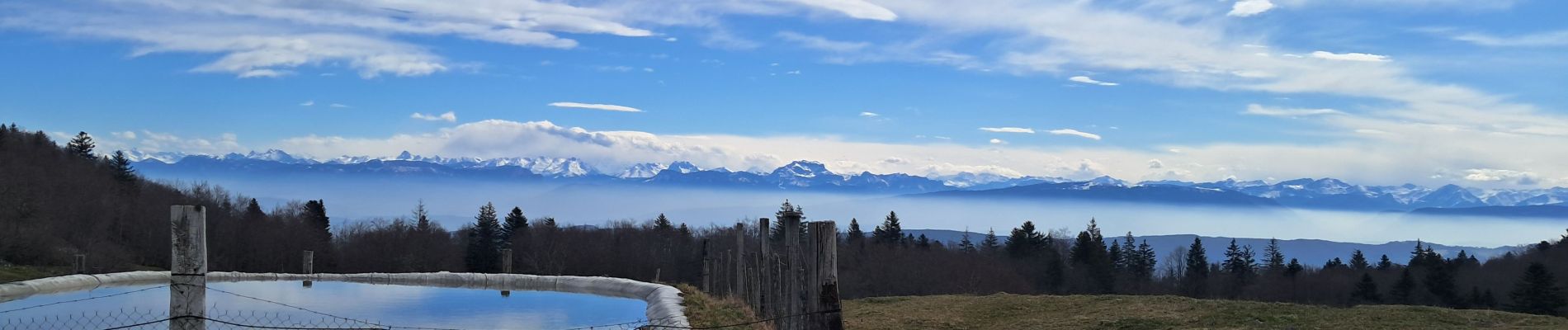
AIN: SUR LYAND - CRETES - CHARBEMENES - VALLON D'ARVIERES - GRANGE D'EN BAS

djeepee74
User


3h38
Difficulty : Easy

FREE GPS app for hiking
 SityTrail
IGN / Geographical institutes
SityTrail Plus
The world is yours!
About
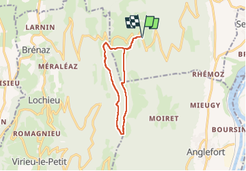
Trail Walking of 10.7 km to be discovered at Auvergne-Rhône-Alpes, Ain, Corbonod. This trail is proposed by djeepee74.
Description
BOUCLE... live du 20250402
Au Km 7.4, une piste forestière a été ouverte récemment, montant probablement, après un dernier virage sur la gauche, vers Falavier.
En quittant cette piste au Km 7.8, par la droite, on se retrouve finalement dans le lit du ruisseau au km 8... dans un parc, avec barbelés, sous le pré supérieur qu'il faut rejoindre... (sans intérêt).
En conclusion: au Km 7.4, rester sur la droite dans le lit du ruisseau afin de rejoindre, quelque dizaines de mètres plus loin, le sentier mappé en pointillés, balisé jaune sur le terrain.
Photos


Positioning
Comments