


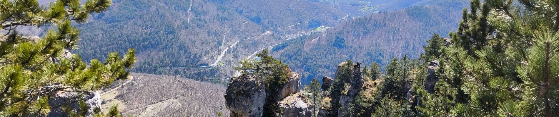
Salancon/ Le Rocher de la Table/ Lonjagnes

tyntyn
User
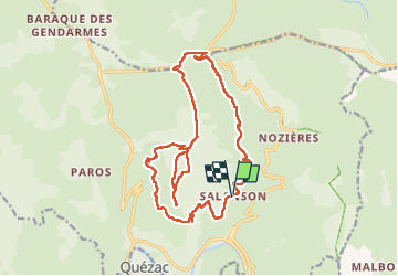

Length
19.7 km

Max alt
1119 m

Uphill gradient
662 m
Km-Effort
29 km

Min alt
640 m

Downhill gradient
660 m
Boucle
Yes
Creation date :
2025-04-01 07:13:39.013
Updated on :
2025-04-04 07:56:28.548
7h23
Difficulty : Very difficult

FREE GPS app for hiking
 SityTrail
IGN / Geographical institutes
SityTrail Plus
The world is yours!
About
Trail Walking of 19.7 km to be discovered at Occitania, Lozère, Ispagnac. This trail is proposed by tyntyn.
Photos


Positioning
Country:
France
Region :
Occitania
Department/Province :
Lozère
Municipality :
Ispagnac
Location:
Unknown
Start:(Dec)
Start:(UTM)
543977 ; 4914971 (31T) N.
Comments